Many trails in Newfoundland are primarily located on old railways. The longest trail is called T’Railway and connects almost the entire province of Newfoundland, from Mount Pearl to Port-Aux-Basques. In fact, at the time of writing this article, it is not possible to go to St-John’s by ATV, the easternmost city in Newfoundland.
The use of the railway stopped in 1988. For a decade there were operations to dismantle the railways. Despite this, fortunately for us, the bridges are preserved. These rights of way having been preserved, they have become maintenance-free multi-use trails: ATVing, cycling, cross-country skiing, horses, snowmobiling, hiking, etc.
In 1997, the main trail became a park called “Newfoundland T’Railway Provincial Park” thanks to the efforts of the T’Railway Council. Trail maintenance is done in collaboration with volunteers, municipal, provincial and federal authorities as well as the Trans Canada Trail Foundation.
Who maintains the trails?
Unlike ATV clubs in Quebec, maintenance is not always done systematically because there are not many funds. They come mainly from governments and voluntary donations. There is no right of access to purchase.
For example, there were major breaks to the trail in the area of JT Cheeseman Provincial Park following Hurricane Fiona in September 2022. The repair had just been completed when we passed on September 11 2023. It took a year before it was fixed. Additionally, signage is almost non-existent, including “stop” signs at intersections.
On certain sections of the trail, snowmobile clubs are responsible for maintaining it in summer thanks to a voluntary contribution of $20. Sometimes municipalities are also involved in these projects, both in monetary donations and in the provision of materials and labor. For the most expensive repairs, the provincial government is generally the main donor.
This is our second trip to Newfoundland. The first was in 2014.
Here is the map of the journeys we made in eight days, from right to left. Each color represents a day of riding.
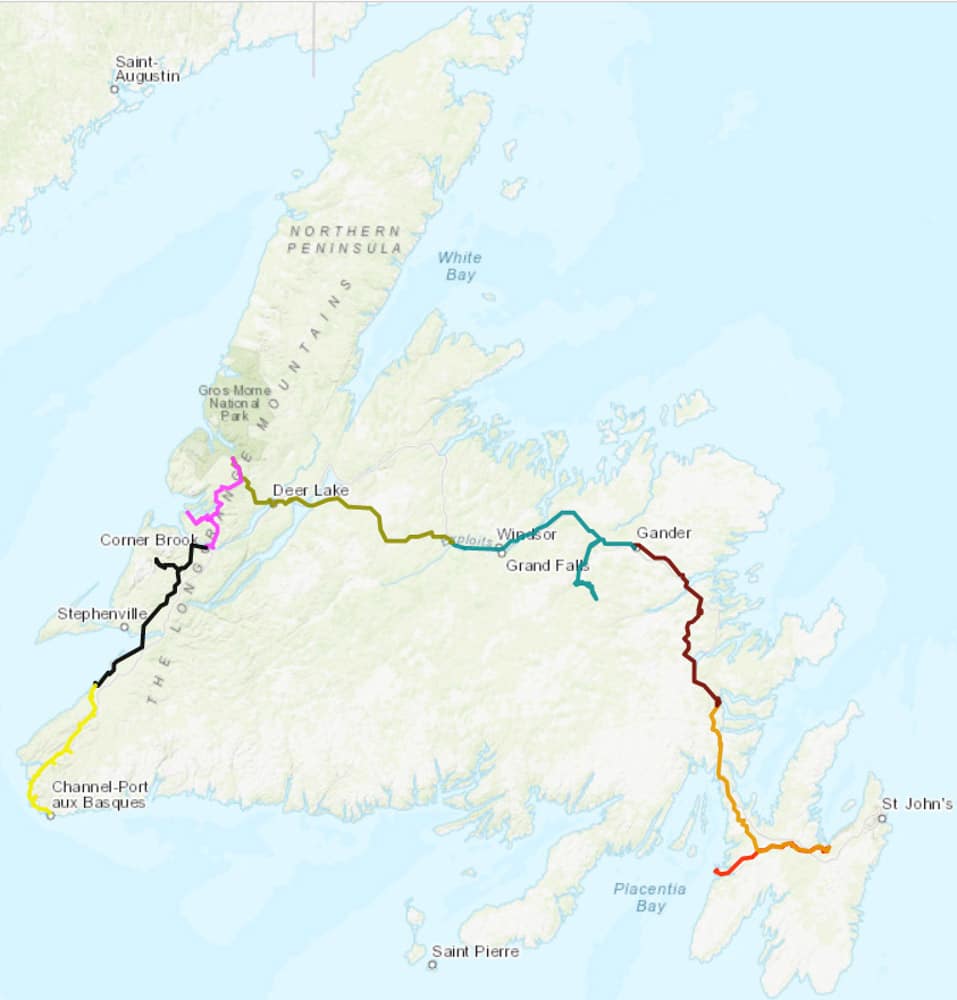
The trails we traveled on in Newfoundland.
September 2 and 3: North Sydney to Argentia (ferry)
My girlfriend Julie and I are leaving Quebec City to go to the port of North Sydney, Nova Scotia. We decided to do it in two days because it is a 13-hour journey and to give us some leeway in the event of a mechanical breakdown. Additionally, in the maritime provinces, there is a time difference of one hour in advance.
Arriving in North Sydney, we leave the vehicle at a parking lot near North Sydney Harbor and board the ferry with our ATVs. We are heading towards Argentia, in the east of Newfoundland. Duration of the crossing: 16 hours, from 5:30 p.m. to 10 a.m. the next morning, local time. In Newfoundland, you have to add 30 minutes more time difference.
We took the “double cabin” option when we purchased the ferry tickets because we wanted to be well rested for the next day’s ride. It’s worth every dollar spent, believe me.
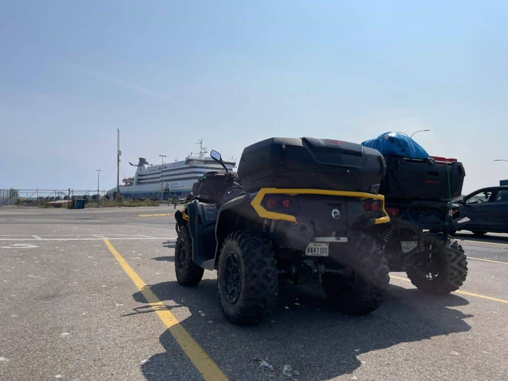
Boarding waiting area, Marine Atlantic, North Sydney.
September 4: Argentia to Holyrood
At 10 a.m., we disembark from the boat and set foot on Newfoundland soil. As access to vehicles on the boat is prohibited throughout the trip, we stop at a safe place to prepare and store our travel bags in the trunks.
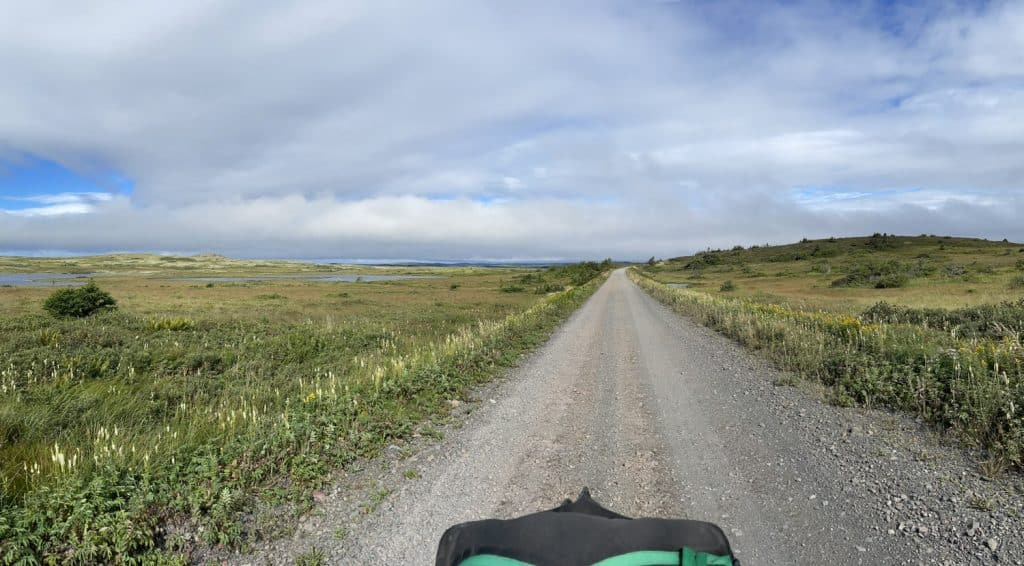
Afterwards, we drive to Whitbourne. The trail is bumpy for the first 15 kilometers, it is full of valleys and water holes. Afterwards, it’s a smooth ride to Whitbourne for a lunch break. We see a lot of ATVs and side-by-sides on the trails, as Monday September 4th is a holiday, Labor Day.
After dinner, we head towards Holyrood. The condition of the trail is atrocious, endless valleys, they are 15 to 20 inches hollow with countless puddles. Newfoundlanders call it “Yes Ma’am”. We are a little discouraged because we wonder if it is like this on the entire island of Newfoundland.
Despite everything, we were able to admire beautiful views from Holyrood. We even walked along a small portion of the still functional railway. A mini-train traveled 1.5 miles back and forth between the Avondale Train Museum and OldMill Campground.
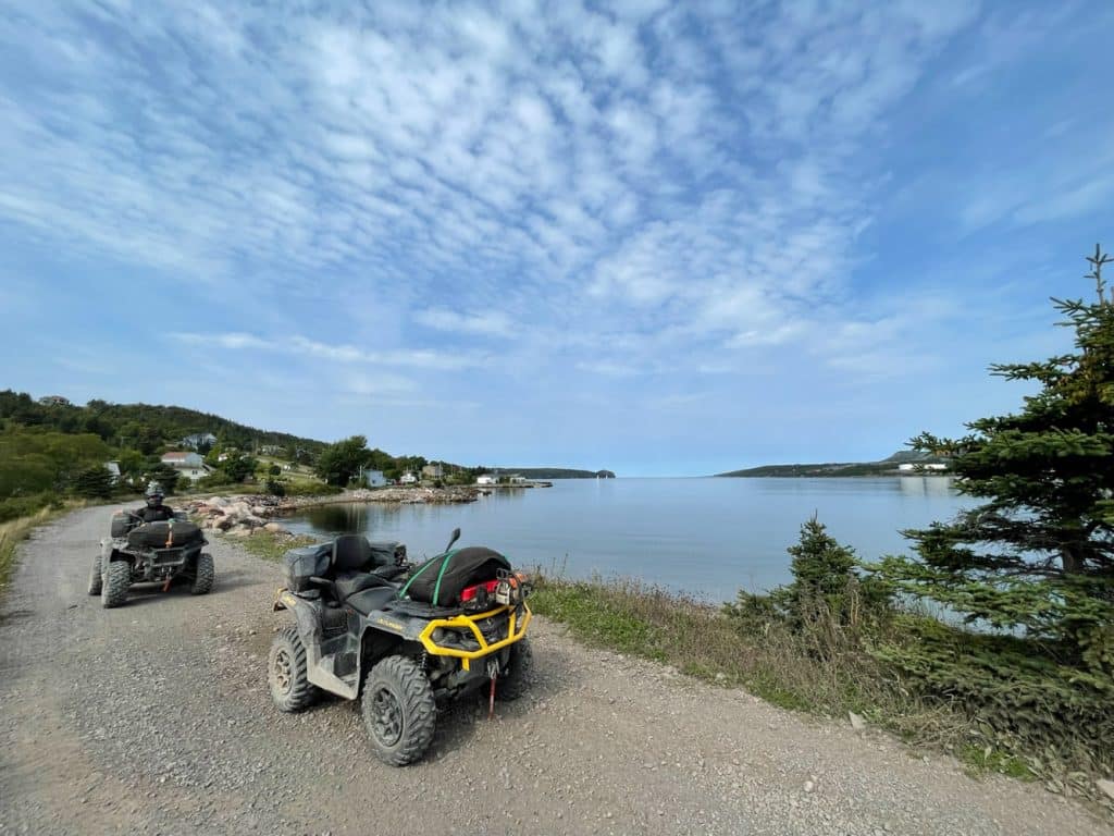
South Arm of Holyrood Bay, Holyrood.
Julie’s 2023 Polaris Sportsman 850 ATV is making funny rear noises. Verdict: rear table bushings to change. Fortunately, I already had the parts in hand, so I took advantage of the moment to change them in the parking lot of the accommodation site.
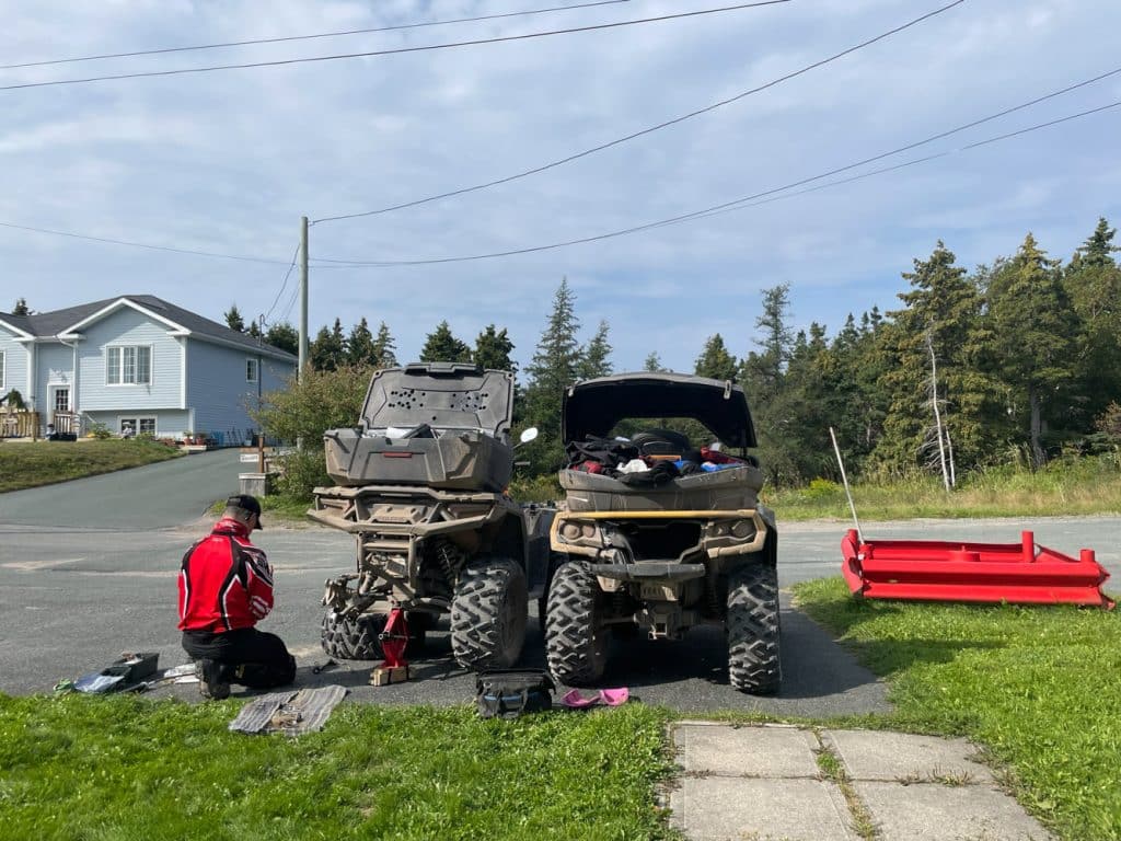
Repairing Julie’s ATV.
September 5: Holyrood to Clarenville.
The morning is cold and rainy. We retrace our steps to Placentia. Given that we have a good idea of the condition of the trail, having adapted our mindset to the current situation, we found it much less difficult.
We drove to Placentia Junction. It’s a fork that leads either to Argentia, where we arrived the day before, or to Clarenville, our destination. From there, the condition of the trail improved considerably; it is not comparable, highways, to our greatest happiness.
Geologically speaking, we are in the central area of Newfoundland called the “Mobile Belt”. Its particularity is to offer us an almost lunar landscape with inselbergs, isolated mounds in the middle of muskeg, a moss quagmire. We are totally disoriented.
We took the opportunity to go to dinner at a “Big Stop”, a good big turkey and vegetable soup. It’s comforting on a cold, cloudy day. Subsequently, the sky cleared, allowing a few rays of sunlight to shine through.
Once we arrive in Clarenville, we take the opportunity to go to Sobey’s to stock up on lunches before going to the hotel. We noticed that there is almost no chicken on restaurant menus, it is mainly turkey. For example, “Hot Chiken” in Quebec is “Hot Turkey Sandwich” in Newfoundland.
“Lunar” landscape between Placentia Junction and Clarenville.
September 6: Clarenville to Gander
The morning is cloudy and cold. The weather forecast announces the start of a heatwave during the day. This is one of the rare sections of trail where there is less to see the entire way. Despite everything, the trail is very beautiful and what’s more, we made a short stop next to the Shute Brook Waterfall, between Thorbun Lake and Port Blandford.
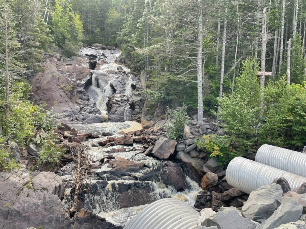
Shute Brook Waterfall.
Afterwards, we head towards Terra-Nova provincial park. We stop on the edge of the bridge to have a snack and admire the view.
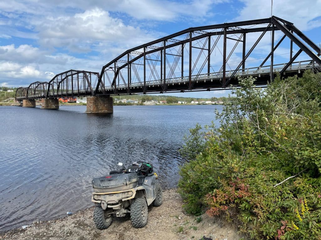
Terra-Nova River Bridge.
The longer the day goes on, the warmer it gets. We arrived in Gander early, around 1:30 p.m., and it was already 28°C outside. The condition of the trail has improved considerably compared to 2014, the first time we made this trip. In fact, according to our memories, we arrived at this place around 4 p.m.
September 7: Gander to Badger
This is the biggest day of the entire trip, as we will take a detour to the Sabena plane crash site. We decide to leave very early in the morning, around 7 a.m., not knowing the condition of the trails, in order to avoid arriving too late at our destination.
We stop at Glenwood to get gas and then leave the T’Railway south to go see the Sabena site. The first 30 kilometers are on a forest road and subsequently, once you cross the bridge, the trail becomes narrower and poorly maintained. We get rubbed by the shrubs on either side. 1 hour 30 minutes later, there was still one kilometer to go before arriving at the site. The trail is very rocky, rocks two to three feet tall, sometimes more. After 500 meters, we decided to leave our ATVs, on the side of the trail. In fact, the rocks are getting bigger and bigger and it’s quicker and less effort to finish on foot.
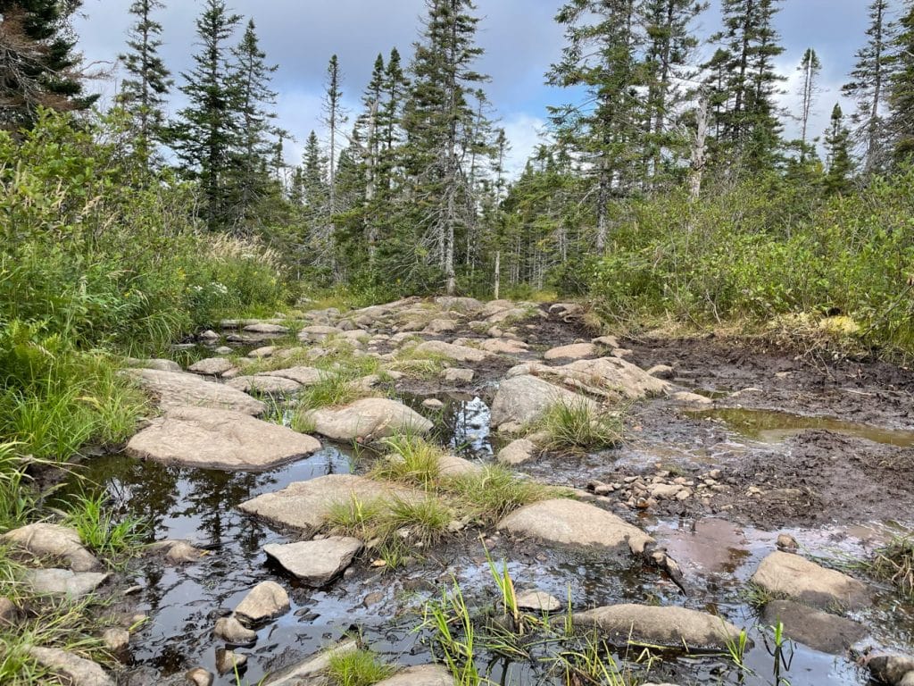
Trail 500 meters before arriving at the Sabena plane crash site.
The crash site
Finally, we arrived at the site. It’s quite special, we feel overwhelmed by a strange emotion. The plane is still there, in several pieces. There is a cemetery nearby. This plane crashed in 1946 and it was the largest civilian crash in the world at the time. There was no equipment to find it and even less to look for survivors.
There were no helicopters to pick them up, they had to be brought from the United States in pieces. Due to the high risks and the great difficulty of access to the crash site, it was decided to leave the plane and bury those who did not survive there.
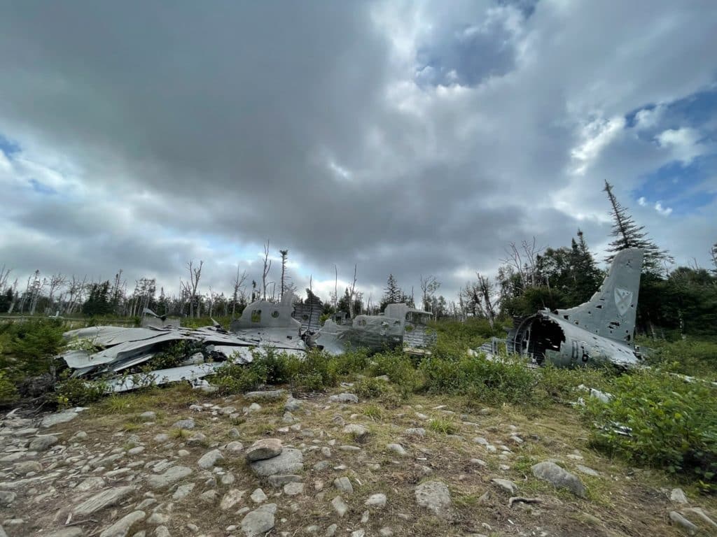
Civil plane, Sabena, crashed in 1946.
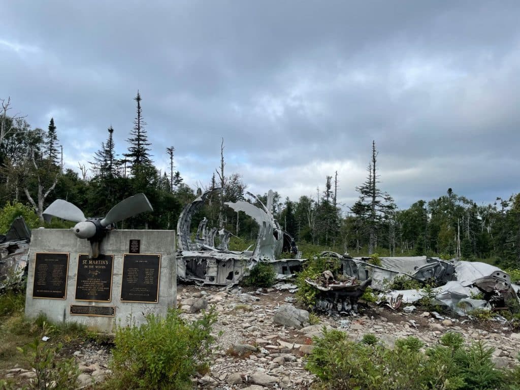
Memorial with the list of survivors and deceased.
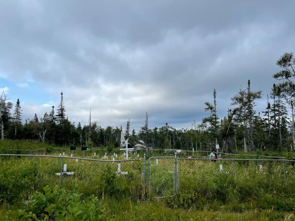
Cemetery near the plane.
Subsequently, we leave this place and retrace our steps. It is already close to noon, we take the opportunity to have dinner on the banks of the Northwest Gander River.
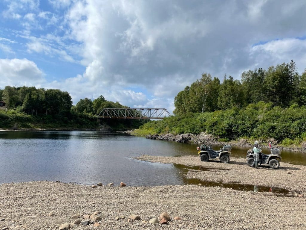
Dinner on the banks of the Northwest Gander River.
Near the bridge there is a village called “Igloo City Recreational Park”. It is a special place because several old buses are converted into chalets.
After this visit, we head north to join the T’Railway. From there, we head towards our final destination, Badger. On the way, we cross the longest trestle bridge in Newfoundland, which is located at Bishop Falls. It is impressive to see, it crosses the Exploit River and is 282.55 meters long. It was built in 1901, over 122 years ago!
Bishop Falls Trestle.
Story to follow in another episode on ATV Trail rider!
Text & Picture: Eric Leblanc